
More Than a Lake Powell Map: Your Entire Trip, Offline, in One App
Download the map once. Navigate 300+ canyons, coves, and landmarks with GPS, no signal needed. Plan the trip — expenses, meals, packing — with your whole crew in one place.
Full access for 3 days · Works offline on the water · Cancel anytime
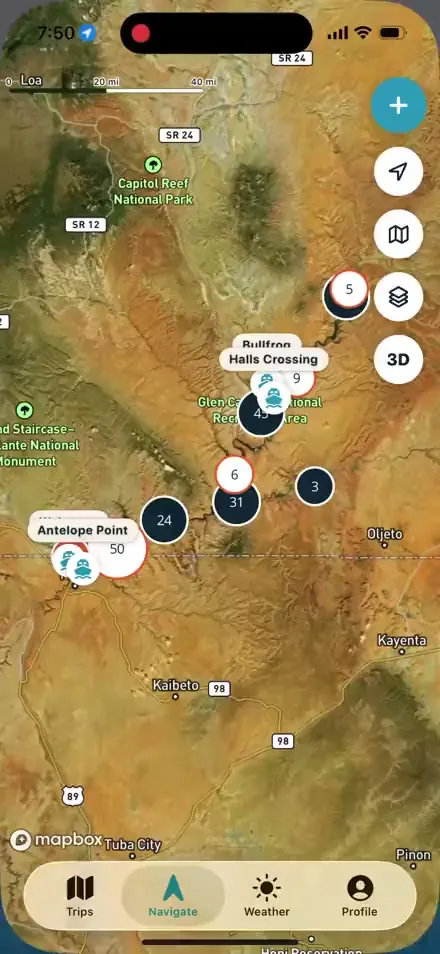
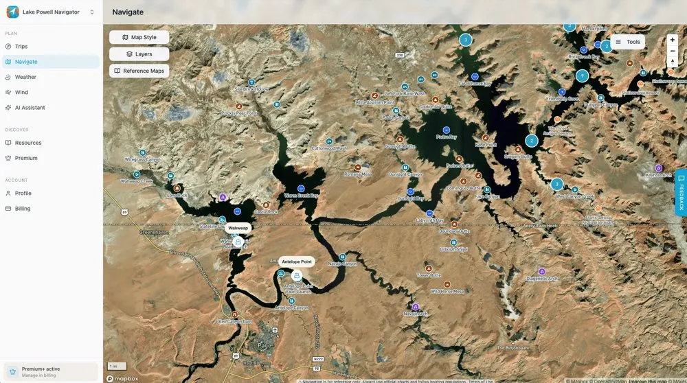
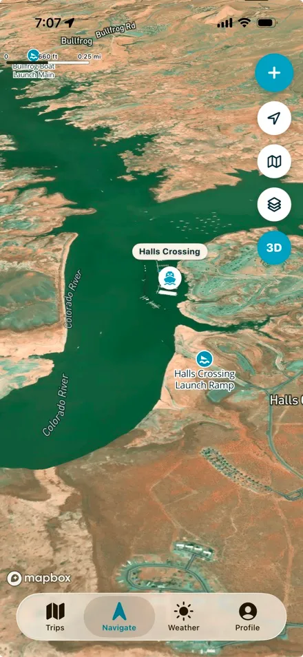
The live map — satellite imagery of the whole lake, with the real names on it.
The Trip Planner That Replaces the Group-Chat Chaos
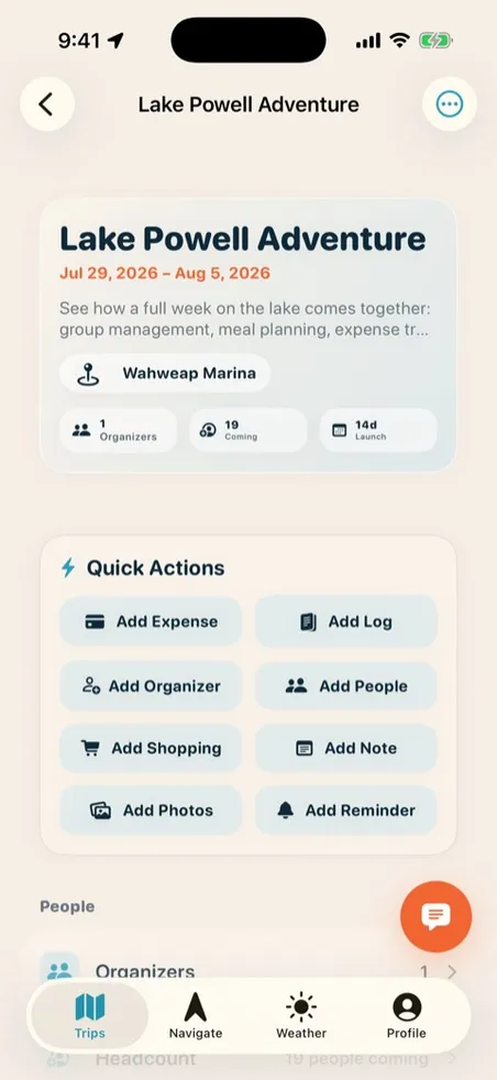
No more scattered text threads and a spreadsheet nobody updates. Every Lake Powell trip lives on one shared dashboard — dates, crew, RSVPs, and a join link that gets everyone in with one tap.
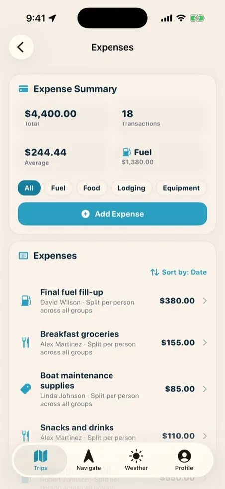
- Track every expense — snap the receipt and AI fills in the rest, split evenly or by category.
- Settle up in seconds — smart settlement reduces the who-owes-whom tangle to the fewest possible payments, exportable to PDF or CSV.
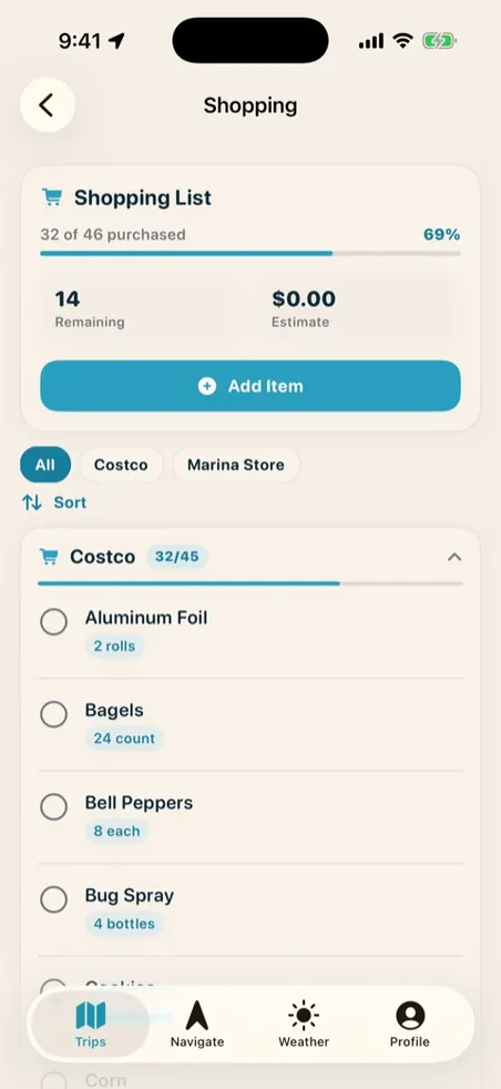
- Shop and pack as a team — real-time shared lists, grouped by store, synced as your crew checks things off.
- Put a name on every dinner — a meal planner with servings and an assigned cook.
- One subscription covers the boat — on Premium+, your whole crew joins free.
The Lake Powell Map with Mile Markers & Canyon Names
Boaters have been asking for a Lake Powell map with mile markers for years — the maps that rank online are printable PDFs and static brochure scans. This is that map: all 61 mile-marker buoys, keyed to the official Glen Canyon Dam mile system, on a live satellite map you can zoom, search, and take with you.
And the mile markers are just one layer. The map carries over 300 points of interest — 132 named side canyons, 48 landmarks you can navigate by sight, 20 named bays and coves with protected water and anchorages, 18 arches and natural bridges (Rainbow Bridge included), every launch ramp, all four marinas, and community-added spots and hazards from boaters on the water.
Explore the full map →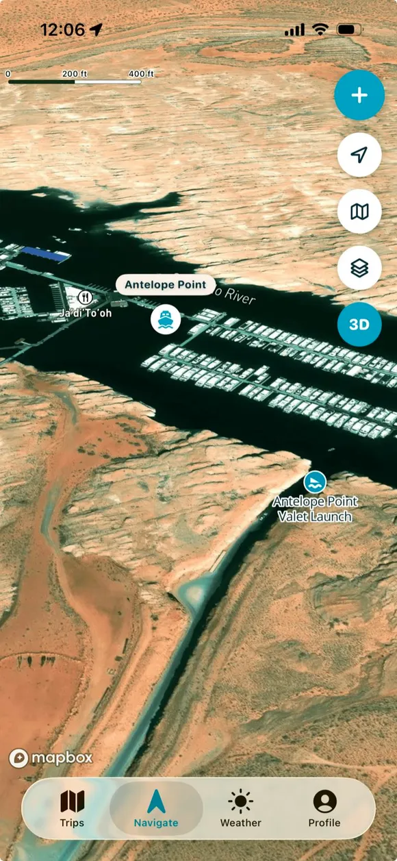 M25 · Buoy layer on
 Download it once at the ramp — every mile marker, canyon, and waypoint works fully offline with GPS, no signal needed on the water.
On Lake Powell, Wind Is the Forecast That Matters
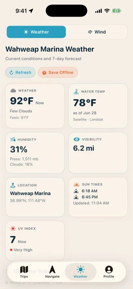
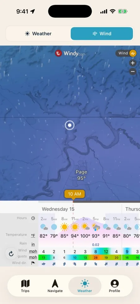
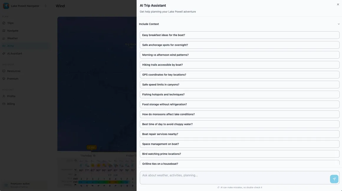
A city forecast from 100 miles away won’t tell you what the canyons are about to do. Lake Powell Navigator reads the weather where you actually are — marina-level conditions and a wind map that shows the wind coming days before it turns a glass morning into whitecaps.
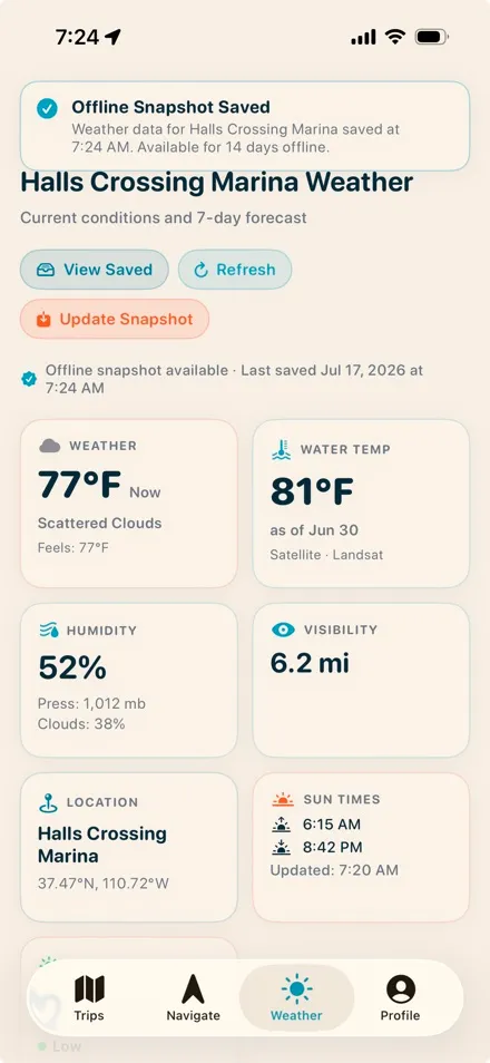
- Marina-level forecasts — current conditions and a 7-day outlook for all four marinas, not a guess from the nearest city.
- Wind, hour by hour — an interactive wind map with a six-day timeline, so you plan the big crossing for the calm window.
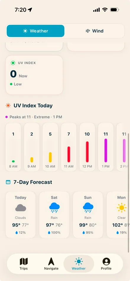
- UV dialed for no shade — hour-by-hour sun exposure for a lake with zero cover.
- Offline snapshots — save the forecast at the marina and carry it up-lake, long past the last bar of signal.
Skip the Printable PDF — This Map Is Always Current
The Lake Powell maps you can print were drawn years ago and show the lake at full pool. This one is different.
| The printable PDF | This map |
|---|---|
| Drawn years ago, shows full pool | Charts that match the lake as it is today, not the 2017 survey |
| Fixed zoom, tiny labels | Zoom from the whole lake down to a single cove |
| No search | Search every canyon, marina, and mile marker by name |
| Useless after sunset on day one | Updates continuously — closures, community hazards, new waypoints |
A Navigation Map That Works Offline, Anywhere on the Lake
Cell signal disappears a few miles from the marina — that’s not an edge case at Lake Powell, it’s the normal state. The iOS app is built for it: download the lake once and you have offline GPS navigation with zero bars — the satellite map, your waypoints, your routes, and background track recording all keep working.
Your trip plans work offline too — shopping list, expenses, packing, logbook — and everything syncs itself the moment you’re back in range.
Get the offline map on iPhone →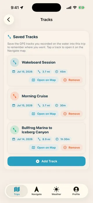
The Lake Powell Navigation App for iPhone & Web
The map is the start. Lake Powell Navigator isn’t a generic boating app with Lake Powell bolted on — it’s built only for this lake, and it’s the Lake Powell app your whole crew plans the trip in and the one that still works 30 miles up-lake.
Plan together
One shared trip dashboard: dates, crew, roles, RSVPs, and a join link that gets everyone in with one tap.
Split the money
Expense tracking with AI receipt scanning and a smart settlement that ends the who-owes-whom math.
Shop and pack as a team
Real-time shared shopping and packing lists, with AI import that turns a photo of a list into the list.
Eat on schedule
A meal planner with servings and an assigned cook for every dinner.
Navigate like a local
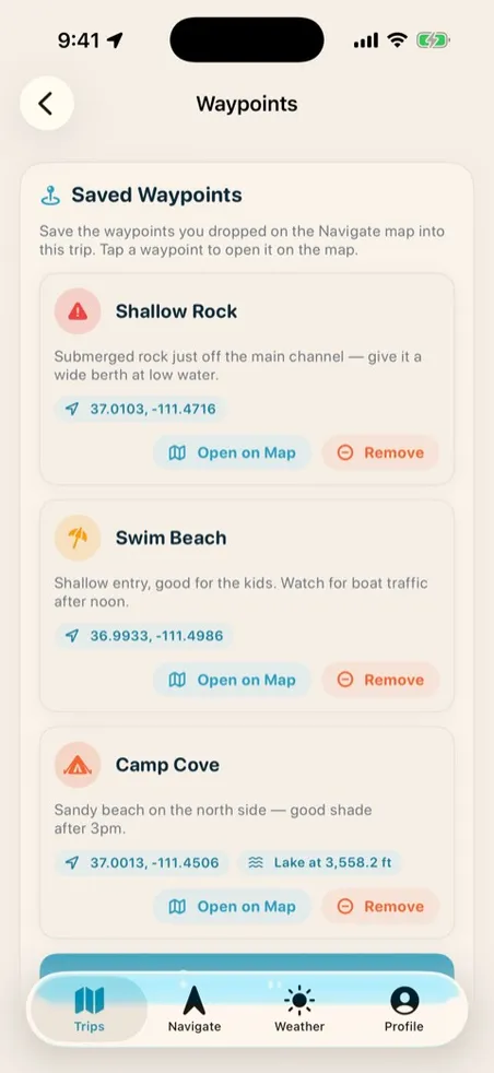
Waypoints, routes, GPS tracks, and 300+ points of interest, offline on iOS.
Know the weather
Marina-level forecasts, wind, and a 7-day UV index dialed for a lake with no shade.
Ask the lake guide
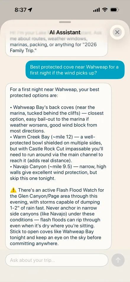
An AI guide grounded in a curated Lake Powell knowledge base and today’s real conditions, not generic chatbot answers.
Keep the memories
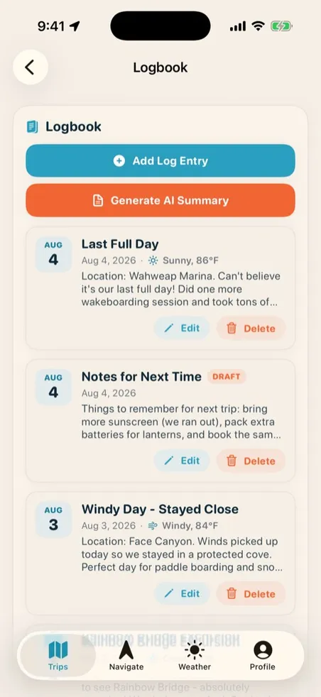
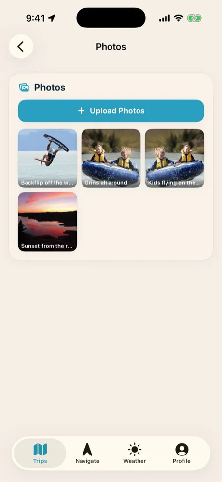
Logbook, shared photo gallery, and a one-tap PDF trip report worth re-reading next winter.
Plan on the desktop, navigate on your iPhone
Lake Powell Navigator runs everywhere — a full desktop web app for planning at home, and an iOS app for the lake. Same account, same trips, one login. Use either one, or both — everything stays in sync.
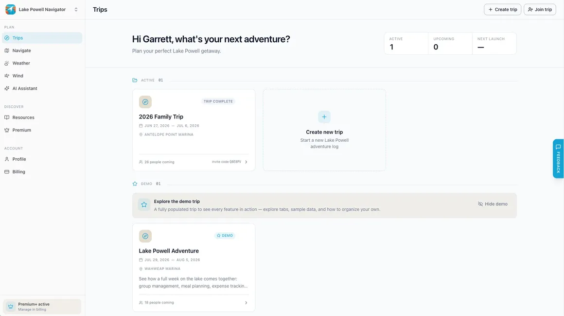
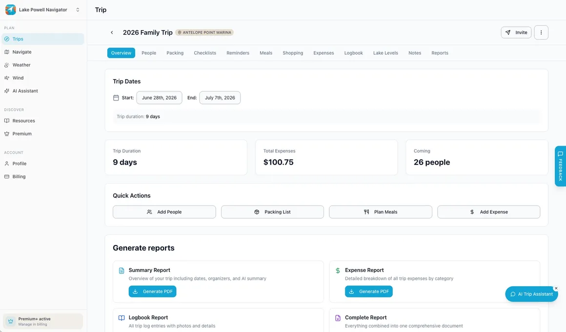
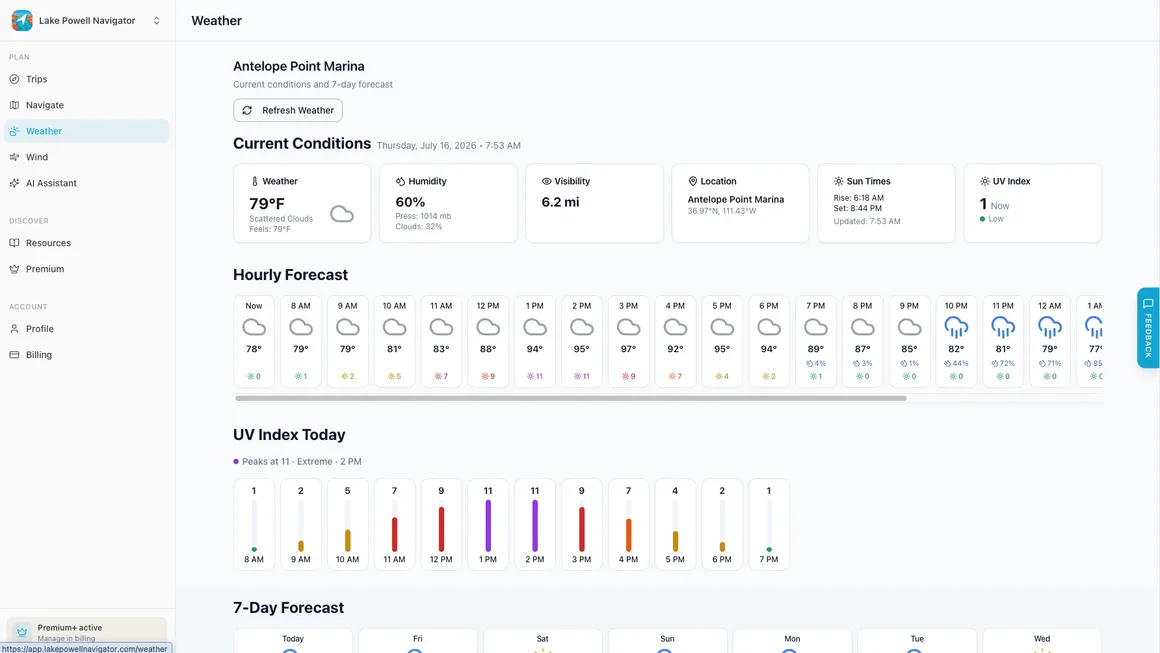
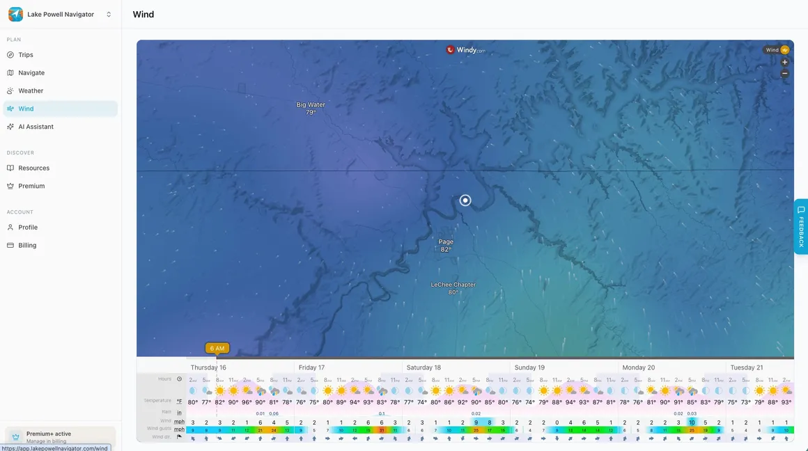
See Every Corner of the App
No mystery screenshots, no “coming soon.” This is the app your crew will actually use, tab by tab.


Start With 3 Days of Everything, Free
The trial gives you all of Premium+ — try it on a real trip before you decide.
Premium
- Unlimited trips
- Full interactive navigation
- Offline maps & community waypoints
- AI lake guide & trip reports
Premium+
- Whole crew joins free on your one subscription
- Share-link invites
- Priority support
Lifetime
- Full access forever
- Pay once, boat every season
- One of the last 79 lifetime spots — when they’re gone, this plan is gone
Full access free for 3 days. Cancel anytime. Start on the web or the App Store — same account, everywhere.
Just browsing? There’s a free tier, too — reference maps with nearly 300 GPS-verified points of interest. Everything else starts with the trial.
Trusted by Lake Powell boaters
“Saved our trip when we lost signal for days. Found amazing spots we never knew existed.”
“The AI knows Lake Powell better than most guides. Incredible for trip planning.”
“Replaced our Garmin and three other apps. Everything works perfectly offline.”
“Fifty miles up-lake, zero cell service, and the map still knew exactly where we were. Worth it for the offline maps alone.”
“We found a slot canyon and a quiet beach we’d motored past for ten years. It paid for itself the first weekend.”
“The wind forecast told us to move the houseboat before the storm rolled in. This app has saved our trip more than once.”
Lake Powell, Answered
Is there a Lake Powell map with mile markers?
Yes. Lake Powell Navigator’s interactive map shows all 61 mile-marker buoys, keyed to the official Glen Canyon Dam mile system, alongside every named canyon and marina. It works in any browser, and the iOS app takes the whole map offline.
Is there an interactive map of Lake Powell?
Yes — Lake Powell Navigator’s interactive map is free to open in any browser: live satellite imagery with all 61 mile-marker buoys, 132 named side canyons, and over 300 points of interest, searchable by name. Unlike the printable maps that rank online, it shows the lake as it is today, not at full pool.
Is there a printable Lake Powell map PDF?
The printable PDFs you’ll find online were drawn years ago and show the lake at full pool — accurate then, misleading now. A live map matches today’s shoreline and updates continuously with closures, hazards, and community waypoints, and the iOS app takes it fully offline — the job a printout used to do.
Where is Lake Powell?
Lake Powell sits on the Colorado River along the Utah–Arizona border, inside Glen Canyon National Recreation Area. The southern end — Wahweap and Antelope Point marinas — is minutes from Page, Arizona, and the lake stretches roughly 186 miles up-lake into Utah.
Is Lake Powell mostly in Utah or Arizona?
Lake Powell straddles the Utah–Arizona border, but the large majority of the lake lies in Utah. The Arizona end holds Wahweap and Antelope Point marinas, near Page.
What’s the closest city to Lake Powell?
Page, Arizona sits at the southern end of the lake, minutes from Wahweap and Antelope Point marinas. Mid-lake access at Bullfrog and Halls Crossing is far more remote — plan fuel and groceries accordingly.
Is there cell service on Lake Powell?
Mostly no. Coverage fades a few miles from the marinas, and most of the lake’s 132 named side canyons have zero signal. That’s why the iOS app downloads the entire map to your phone — offline GPS navigation, waypoints, routes, and track recording all keep working with zero bars.
Is there a Lake Powell navigation app?
Yes — Lake Powell Navigator is a Lake Powell navigation app built only for this lake, on iPhone and the web. It pairs an offline satellite map carrying over 300 points of interest with marina-level weather, group trip planning, and an AI lake guide grounded in current conditions.
How much does Lake Powell Navigator cost?
Premium is $9.99/year, Premium+ is $12.99/year with your whole crew joining free, and Lifetime is $79.99 once. Every plan starts with a free 3-day trial of everything in Premium+, and a free tier offers reference maps with nearly 300 GPS-verified points of interest.
What is the prettiest part of Lake Powell?
Ask five boaters, get five answers — but the named side canyons are the usual favorites: Antelope, Labyrinth, West Canyon, and the run up to Rainbow Bridge. The map carries all 132 named side canyons, so you can pick your own.
What town is under Lake Powell?
Hite, Utah — a small ferry-crossing settlement near the mouth of the Dirty Devil River — was submerged as Lake Powell filled behind Glen Canyon Dam in the 1960s, along with hundreds of ancestral Puebloan sites in Glen Canyon. Today’s Hite outpost sits above the original townsite at the lake’s far north end.
Is Dangling Rope Marina open?
No — the mid-lake fuel stop is closed, which leaves roughly 100 miles between Wahweap and Bullfrog with nowhere to refuel. The app tracks where fuel is available today.
How full is Lake Powell right now?
For current elevation, charts, and history, see lakepowellwaterlevel.com.
Wahweap to Halls Crossing: All Four Lake Powell Marinas, Covered
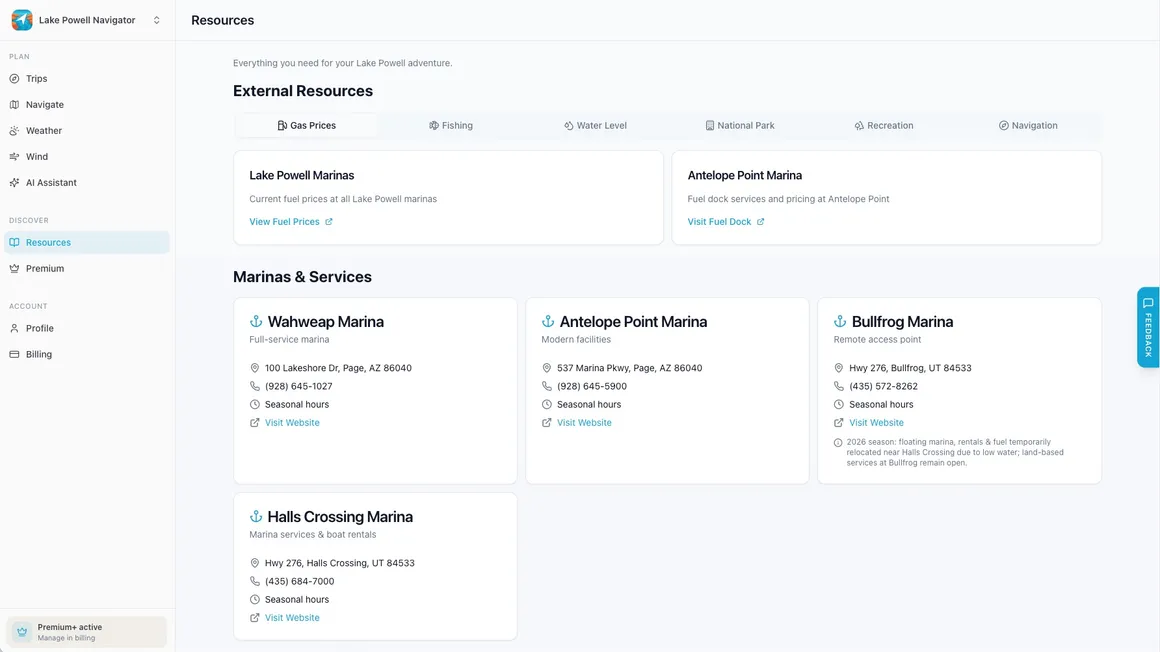
Every marina is on the map with its ramps, fuel, and services — and the app’s Resources hub keeps fuel prices, ramp status, fishing reports, permits, and emergency contacts one tap away.
Wahweap Marina
The south-lake hub minutes from Page, Arizona — the busiest launch on the lake.
Marina guide →Antelope Point Marina
The south lake’s other gateway, on the Navajo Nation side near Page.
Marina guide →Bullfrog Marina
Mid-lake access up-lake — far more remote, so plan fuel and groceries ahead.
Marina guide →Halls Crossing Marina
The quiet side of mid-lake, directly across the channel from Bullfrog.
Marina guide →Plan It Together.
Navigate It Offline.
Your next Lake Powell trip, in one place — and it keeps working when the signal’s gone.
Full access for 3 days · Works offline on the water · Cancel anytime